

doClimate philosophy
Our purpose is to increase the accessibility of robust climate project services. This includes holistic project development from scoping to final proposal development, or delivering specific tailored solutions in the form of climate rationales and analysis, risk and vulnerability assessments, spatial analysis, social vulnerability, and stakeholder, or development industry climate training. Additionally, we have built relationships with experienced professionals covering most aspects of climate development requirements.
The principles to which we ascribe are to provide industry-leading, actionable and robust delivery specific to the needs of the project, the beneficiaries, the decision makers, the client, and the funding agencies.

Climate vulnerability assessment for Sustainable Communities for Climate Action in the Yucatan Peninsula (ACCIÓN Yucatan)
Team leader. The project objective is to conduct a pre-feasibility study pre-feasibility study to assess the vulnerability of selected ecosystems, productive systems, and communities following GCF’s requirements and guidelines and build a robust climate rationale for the ACCIÓN project to demonstrate the ability of the proposed activities’ potential to adapt to the impacts of climate change while promoting sustainable development and a paradigm shift in the Yucatan Peninsula

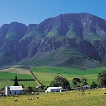
Newinbosch Estate Climate Adaptation Plan
Team leader. Delivered the Climate Adaptation Plan (CAP) for the requirements of 4.1 Climate adaptation of GOV-4 Community Resilience credits for the Green Star SA Sustainable Precinct dispensation for the Newinbosch Estate in Stellenbosch.

Lesotho WEF Nexus GCF SAP
Climate change specialist. My work sought to provide the climate rationale for Lesotho giving over all projected climate changes and providing regional priority for intervention as well as at the local scale assessing high-resolution temporal changes in the climate impact parameters affecting water, food, and energy nexus.

Blue-Green Investment Corporation (BGIC) in Barbados
Climate change specialist. This GCF project will provide funding for green, affordable, gender-inclusive housing, energy generation, water conservation, food security and low-carbon transport initiatives and technologies. The BGIC is envisaged to become a significant institution for practical and strategic financing of climate change adaptation and mitigation policies and measures, supporting the Governments of Barbados to achieve national resilience and emissions reduction targets. My work related to providing the historical and projected climate baselines for BGIC lending operations and providing the rationale for intervention planning.

Recharge Pakistan
Climate change and GCF ITAP specialist. David reviewed the work done on the Recharge Pakistan climate and hydrological assessment. He identified and strengthened the technical adaptation component. The project sought to mitigate flood and drought impact in the Indus River basin through EbA and green infrastructure interventions. David enhanced the climate rationale and hydrological assessment and improved the technical robustness of the project such that the project proposal met with technical barriers associated with the GCF ITAP process.

Climate rationale for Egypt, Kenya, Nigeria, and South Africa
Climate change specialist. The project was in the initial feasibility assessment phase and required an assessment of broad-spectrum climate changes to inform the project development pathway. The analysis included historical impacts and trends, projected changes to standard annual and monthly climate variables of temperature and precipitation, changes in extreme events and hourly precipitation rates, heatwaves, drought potential and potential renewable energy feasibility

Drakensberg 2022 seasonal impact assessment
Meteorological and disaster risk specialist. The flooding in KZN in 2022 was devastating to the local communities and infrastructure. An assessment of the observational rainfall changes in the last 40 years was undertaken to determine the long-term rainfall trends in this region and if return events of this nature are in line with potential projected future occurrences. The assessment focused on the convective rainfall anomalies from Jan-April 2022 to assess the timing, magnitude, and spatial variance from climatological norms

SADC drought assessment
Climate change specialist. The project looked at the long-term future climate changes in the SADC region, most significantly the changes in rainfall and how that may lead to future meteorological drought with impacts on the agricultural and water security sectors. The spatial assessment was undertaken at the national level while a detailed statistical assessment was done at the Köppen climate zone scale giving more detailed future impacts at the sub-national resolution.

Heritage Colombia (HECO): Maximizing contributions of Sustainably Managed Landscapes in Colombia for achievement of Climate Goals
Climate change and GCF ITAP specialist. The GCF application required further development of the technical climate rationale. This included climate trend and seasonality analysis, model validation and scenario justification and long-term extent of change. CCliC was contracted to build robustness into the adaptation component of the project such that the project proposal met with technical barriers associated with the GCF ITAP process.

Climate change analysis and Climate change vulnerability assessment of 14 Local municipalities in South Africa
Climate change and GIS analyst. Climate Change Vulnerability assessments (CCVA) were conducted in the 14 selected local municipalities in South Africa. The assessments focus primarily on the themes of Natural and Managed Ecosystems (NME) and Community and Livelihoods (CL). This is done to provide two distinct pillars of environmental change. These assessments are further broken down into physical climate exposures (hazards). These exposures are heatwaves, cold snaps, flooding, drought, and rainfall variability. The assessments allowed for the prioritisation of the top three most vulnerable to climate change. These are selected for the development of concept notes for climate intervention.

Effective Management of the Peruvian Amazon Protected Areas for Climate Change Mitigation and Adaptation
Climate change and GCF ITAP specialist. Development, advisory and analysis for the adaptation component of the GCF-funded management of Peruvian forests for the WWF. The project entailed providing custom analysis informing the climate rationale and meeting GCF ITAP requirements. Adaptation interventions were aligned with the outcomes from the stakeholder engagement with indigenous communities. This included building climate resilience into local livelihoods, diversifying opportunities and market access, and utilisation of non-timber forest products to provide realistic and functional alternatives to forest and ecosystem degradation activities. The team was contracted to build robustness into the project such that the proposal met with technical barriers associated with the GCF ITAP process.

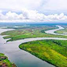
Climate Modelling and GIS Mapping of three estuaries in Mozambique assessing the role of tropical cyclones as risk multipliers
Climate change and land cover logical assessment technical lead. Development of climate and land-use and tropical cyclone impact analysis in the Limpopo, Zambezi, and Bons Sinais estuaries for the development of the Funding Proposal for this GCF-funded project. These estuaries are home to a variety of climate-exposed livelihoods including agriculture near the riverbanks, and fishing. The noted impacts are the large flooding events, the saline intrusion from a rising ocean and storm surges associated with high-intensity tropical cyclones. The objective of this project is to highlight the logical cause and effect relationships of various impacts allowing for the design of intervention activities promoting more sustainable and protected land-use activities.

Sierra Leone Coastal Resilience
Vulnerability Specialist. The project sought to identify hotspots of the ecosystem and social vulnerability though the assessment of mangrove ecosystems changes over time and changes in social indicators. The intention of the project is to highlight locations for and possible intervention types to enhance local livelihoods and enhance education on ecosystem sustainability.

Climate Mainstreaming Facility: Multi-Annual Country Strategies (MACS)
Climate change and program advisor. The project seeks to support the uptake of climate information, climate risk analysis and adaptation assessment, providing practical advice to support advisors and programme teams in mainstreaming climate risks into donor core development work.

Vulnerability and Risk Assessment of Water, Sanitation and Hygiene (WASH) for Mbombela
Climate and vulnerability analyst. The project will identify and address the impacts of climate change on the access of vulnerable areas in Mbombela concerning fresh water, sanitation, and hygiene. The project consisted of detailed spatial vulnerability analysis and long-term projected climate exposure.

Alfred Nzo District Municipality Disaster Risk assessment
Disaster Risk analysis. The Risk assessment was conducted under the structure of the Disaster Management Act 2003 as part of the legislative mandate of district municipalities. The risk assessment looked at meteorological (flooding, drought, wind, and lighting) and environmental (Alien vegetation, fires, and deforestation) hazards in the context of local physical and social vulnerability and coping capacities. The spatial risk was then correlated to population density, Agricultural activity, and physical context.

Building the resilience of urban populations in Laos with ecosystem-based adaptation (EbA)
Disaster risk lead. Supporting the development of a Feasibility Study and Funding Proposal for this GCF-funded project. The project will be implemented in six cities in Laos. The Laotian cities of Vientiane, Luang Prabang, Paksan, Savannakhet, Thakek and Pakse are rapidly growing urban areas directly adjacent to the Mekong River. All six cities are impacted by river flooding and flash floods, both of which will be exacerbated by climate change. The outputs of this project will: i) improve policy and planning for urban EbA and flood management; ii) build local institutional capacity for managing urban EbA; iii) build the resilience of vulnerable urban areas to both river and flash floods using urban EbA; and iv) facilitate knowledge-sharing around urban EbA for flood management.

Strengthening Climate Service and Multi-hazard Early Warning for Resilience in Sudan
Spatial data and early warning specialist. Development of a Simplified Approval Process Concept Note and Funding Proposal for submission to the GCF. The project objective is to build the technical capacity of countries within the Intergovernmental Authority on Development (IGAD) region through regional cooperation, ensuring that climate forecasts and projections can be generated and disseminated effectively and timeously to inform early action. This will be achieved by i) increasing the capacity to generate and use downscaled climate forecasts and projections at regional and national levels; ii) mainstreaming climate information into key policies and programmes of IGAD and its member states, and iii) developing regional systems to facilitate early action on extreme climate events.

Jordan Integrated Landscape Management Initiative
Resilience, Spatial data and climate specialist. Development of a Funding Proposal and Feasibility Study for this GCF-funded project. The objective of the project is to increase the resilience of vulnerable communities in the Jordan Rift Valley to the adverse impacts of climate change, including the increased frequency and intensity of extreme climatic events such as droughts and floods. This objective will be realised through Integrated Landscape Management (ILM) across five ecosystems (forest, wadi, marine, rangelands, and agriculture).

Resilience to hurricanes, floods, and droughts in the building sector in Antigua and Barbuda
Resilience, Spatial data and climate specialist. Development of a Feasibility Study and Funding Proposal for this GCF-funded project. The project will build the climate resilience of Antigua and Barbuda to the impacts of hurricanes by i) supporting the mainstreaming of climate-proofing measures into funding mechanisms, policies and standards for the building sector; ii) strengthening technical capacity for planning, implementing and monitoring climate-proofing and other adaptation interventions in the building sector; iii) assessing barriers, identify financial instruments, and develop operational guidelines to enable the private sector to access funding for adaptation in buildings; iv) climate-proofing identified public buildings to improve resilience to extreme climate events – including tropical storms, hurricanes, droughts and extended dry periods, floods and rising air temperatures – and improve adaptation interventions during such events; and v) developing and implementing plans for climate-proofing activities and interventions in community buildings.

Business Continuity, Emergency and Crisis Management Systems updating and training
Emergency procedures lecturer. Review of Abu Dhabi Department of Transport Business Continuity, Emergency and Crisis Management Systems and standard operating procedures (SOPs) to ensure alignment with National Emergency and Crisis Management Authority (NCEMA) and best practice IS0 22 301 standards. My experience in emergency response meant that I was well suited to lecture the emergency standard operating procedures with relatable and practical examples to bring meaning to the SOPs for the stakeholders.

Tactical Radio Network for the Buffalo City Metropolitan Municipality: Feasibility and Technical Specifications
Project leader. Buffalo City Metropolitan Municipality (BCMM) required the design and implementation of a tactical radio network for first responders in their area. The purpose of this project is to research and supply specifications for an effective tactical radio network for emergency services in BCMM to enhance the reliability and usability of communications technology to better serve the population and area of BCMM. To effectively address the problem expressed by BCMM, this project sought first to assess the needs within the municipality and applicable technology analysis to the stakeholders that would use communication technology in operations in the form of a feasibility study assessing stakeholder requirements and potential technology solutions over varying well as assessing varying coverages. The Design and Specification Report described the requirements for a new radio network based on digital trunked radio technology suitable for the needs of BCMM Emergency Operations and Disaster Management Departments. My responsibility for this project was to coordinate the technical resources responsible for the detailed radio specification and to deliver the stakeholder needs assessment. Furthermore, cognisance and adherence to client-specific needs and feedback throughout the project were fundamental to the successful delivery of the project.

Review of the Drakenstein Spatial Development Framework
Resilience and Climate Change analyst. The team was appointed to undertake a review of the Drakenstein Spatial Development Framework (SDF), encompassing the compilation of a Spatial Development Framework including the incorporation of environmental, geotechnical, physical, economic, local economic development, tourism, transportation, and other specialist studies into a planning document for the local authority. In this project, I was responsible for the spatial climate change analysis and implications thereof to the varying components of the bio-physical sector.

Buffalo City Disaster Sector Plan
Project leader and stakeholder facilitation. This project required the development of sector plans and field operations guidelines for multidisciplinary disaster response in the Buffalo City Metropolitan Municipality. The team was appointed to collate pertinent operational information from first responders and those that work on secondary response and longer-term incident stabilisation. Further requirements were to develop an implementation plan and budget for streamlining response. All documentation was consolidated, and a discussion document was put forward for public comment. The resulting document was workshopped with both the technical professionals and the councillors represented in the area. The final policy, implementation plan and budget were handed over to the municipality's disaster management for further implementation. In addition to leading the project, I was primarily involved with stakeholder engagement and extracting their context-specific needs and operational objectives and balancing those against other stakeholder priorities. I was required to graphically represent the stakeholder SOPs in varying emergencies and represent the responder’s operational relationships throughout an incident.

Shell vs Wild Coast: Marine protected area survey
GIS specialist. Shell intended to prospect for conventional gas using seismic surveys off the Wild Coast, South Africa. This however caused a significant uproar from the South African public and was brought to the Makhanda high court for judgement. Part of this work was providing updated and validated spatial data showing survey areas of interest in proximity to marine protected areas and critical biodiversity areas in support of the urgent interdict to review the local impact of such activity.

Mapping of Marine protected areas
GIS mapping. Two NGOs, the South Durban Community Environmental Alliance and WildOceans, challenged the environmental authorisation granted to Eni / Sasol for exploration activities offshore of the KZN coast. Accurate mapping was done to show the distances of the MPAs, and CBAs from the Eni Sasol proposed offshore drilling areas of interest. Work was undertaken due to concerns about the impacts of the drilling, including a catastrophic oil spill, on the ocean environment, particularly the impacts on the MPAs and CBAs

Angola-Namibia transmission line
GIS and Climate trainer. An environmental assessment was required for the development of a transmission line between Angola and Namibia. Part of this assessment was an evaluation of current and projected climate impacts for the region. I provided hands-on climate training and materials as the team undertaking the environmental assessment did not have the capacity to undertake this climate evaluation. The training focused both on the factors that influence climate dynamics and variability as well as a practical walkthrough on downloading the data and performing the spatial and statistical analysis.

Monrovia Metropolitan Climate Resilience Project
GIS and Climate Technical reviewer. Development of a Funding Proposal for this GCF-funded project. The project objective is to increase the resilience and adaptive capacity of coastal communities in Monrovia to the impacts of climate change, particularly sea-level rise, and coastal erosion. This will be achieved by i) designing and constructing a rock revetment to defend the West Point community against coastal erosion and storms; ii) increasing the institutional capacity and providing policy support for the implementation of Integrated Coastal Zone Management, and iii) protecting mangroves and strengthening gender- and climate-sensitive livelihoods to build local climate resilience in Monrovia.

Strengthening the resilience of the most vulnerable coastal communities to climate change in the Philippines’ Eastern Seaboard
Spatial data specialist. Development of a Feasibility Study and Funding Proposal for this GCF-funded project. The project will support the Government of the Philippines to enhance the resilience of vulnerable coastal communities along the Eastern Seaboard to climate change and extreme weather events. The project will catalyse a shift towards ecosystem-centred and community-based approaches to adaptation in the country’s approach to coastal planning and development, with a focus on Integrated Coastal Zone Management. This will be achieved by i) assessing the vulnerability of coastal communities to extreme climate events; ii) supporting the community- and ecosystem-based livelihoods which are resilient to climate change; and iii) integrating climate change into local planning, including comprehensive land use plans for vulnerable coastal zones.
Breede Valley Municipality Spatial Development Framework
GIS, Climate Change and Risk analyst. Breede Valley Local Municipality required the review of the Municipal Spatial Development Framework (SDF) to be adopted by Council in terms of Section 25 of the Municipal Systems Act (Act 32 of 2000). This required, among other tasks, a review of climate change impacts on the biodiversity sector. In this project, I was responsible for the spatial climate change analysis and the varying meteorological implications on components of the bio-physical space. This included geology, soils, water resources, and agriculture.
Luapula River Hydroelectric Scheme
GIS, Climate Change and Risk analyst. Pre-feasibility studies for the environmental and social impact assessment (ESIA) opportunity for the proposed Luapula River Hydroelectric Scheme was required by the joint Zambia and the Democratic Republic of Congo governments. This was required to facilitate the development of hydropower on the common sites of the transboundary Luapula River. The team undertook the pre-feasibility studies for the environmental and social impact assessment for the development of the proposed Luapula River Hydroelectric Scheme which includes multiple dams with capacities ranging from 600 to 900 MW. This project would help secure the electricity supply for Zambia and the Democratic Republic of the Congo. As part of this project, I supervised the technical climate change and meteorological impact analysis. This included baseline and multiple projected scenario assessments highlighting impacts on the physical infrastructure but also how climate changes may influence operational efficiencies.

Botswana-South Africa Transmission Interconnection Project: Environmental and Social Impact Assessment
GIS and Climate change analysis. The RSA-Botswana Transmission Interconnector Project entails the construction of approximately 560 km, 400 kV transmission line between South Africa and Botswana. The project required a scoping study, and a feasibility study up to the project implementation phase which included an environmental impact assessment, and outlining engineering, procurement, and construction specification.
I undertook an advisory role in climate analysis and risk screening along the proposed transmission line, thereby giving a greater understanding of likely climate change risks faced. This will ultimately facilitate the consideration of climate change vulnerability and likely impacts at the project level during the project planning and design

South African National Biodiversity Institute (SANBI): Working for Wetlands Programme
Geographic Information System (GIS) Technician. The team was appointed to conduct the planning and implementation of rehabilitation interventions for the Working for Wetlands Programme. The focus was on wetland conservation, poverty reduction through job creation and skills development. The project's key objective was to support and enable the protection, rehabilitation, and sustainable use of South Africa's wetlands through cooperative governance and partnerships. The main work components included assessing wetland health for identification and prioritisation of remedial measures, obtaining environmental authorisation, and undertaking the engineering design and site support for the implementation thereof. My work was spatial data collation, verification, and management. Furthermore, I was responsible for building efficiencies in automating the creation of map sets for the basic assessment reports and dissemination to public stakeholders.

Impofu Wind Farms mapping
Adaptive mapping specialist. The team was required to undertake environmental impact assessments (EIAs) for three wind farms for the proposed Impofu Wind Energy Facility. A basic assessment report was undertaken for associated grid connection infrastructure to connect the wind farms to one of two existing substations in the Nelson Mandela Bay Municipality. The consistently changing status of project progress required a visual tool that could serve as a spatial dashboard to present an updated status. This project required me to develop this dynamic spatial dashboard.

Chatty / Jachtvlakte Precinct Planning
GIS and Climate Change analyst. Development of precinct plan which will illustrate the future spatial structure of Chatty/Jachtvlakte Precinct. This precinct plan aims to enable mixed-use intensification and densification around Chatty Link Road, Bloemendal Arterial and Standford Road extension through a comprehensive precinct plan, business plan and implementation framework. I was responsible for the high-level climate change risk analysis required for the long-term applicability of the project recommendations.

Drakenstein Drought Response Action to “Day Zero”.
Technical Lead, GIS, and vulnerability identification. The team was required to provide technical and practical management to Drakenstein Local Municipality Disaster services in preparing for the “Day Zero” crisis. Requirements are spatial analysis and temporal modelling of populations in response to a “Day Zero” scenario. Site layouts, specifications and costings for water points and larger scale logistical considerations/constraints. I was responsible for building the model to address the complex Day Zero scenario which required adaptive real-time population and spatial modelling. The model highlighted population vulnerabilities and dynamically presented adaptation options to address these. Furthermore, I was responsible for designing each of the site layouts so that they were able to accommodate the likely daily population but were also adaptable to changing population requirements.